In summary
CalFire released its fourth and final round of color-coded hazard maps. Different colors come with different rules.
New bursts of yellow dot the hills of Mendocino County.
Smears of burnt orange now span the aqueduct near Bakersfield.
A fresh splash of crimson juts east of Chico like a fresh wound.
With the release of its fourth and final round of color-coded hazard maps this morning, California’s firefighting agency is showing just how much of the state is prone to wildfire — and how much that computationally-modeled danger zone has grown since the state issued its last round of local hazard maps more than a decade ago. Visit osfm.fire.ca.gov/what-we-do/community-wildfire-preparedness and scroll down to “Explore Fire Hazard Severity Zones” to plug in your address to see how your home is designated.
With a few notable areas where the orange and red tide receded, like the hills above Berkeley and Oakland, territory deemed “high” or “very high” hazard exploded across the state, increasing by 168% since 2011.
All told, the size of these orange and red patches on the new maps is 3,626 square miles — an area nearly twice the size of Delaware.
That’s home to roughly 3.7 million people, according to a CalMatters analysis which combined the maps with finegrain population estimates from University of California researchers.
That means roughly 1-in-10 Californians are subject to an array of building code, defensible space and real estate disclosure rules, all of which could have lasting effects on how people live, communities plan and housing markets function in the state’s most flammable neighborhoods.
California’s Department of Forestry and Fire Protection, CalFire, has been releasing these maps in installments over the last six weeks, beginning with counties in the state’s far north and ending today with Los Angeles, Orange County, San Diego and everything inland south of Owens Valley.
They only cover the cities and towns where local fire departments are responsible for managing wildfire. The parts of the state where CalFire is in charge were remapped in late 2022 and also depicted a spike in hazard zones. Federal lands, which account for about 45% of all the land in California, are not included in either set of maps.
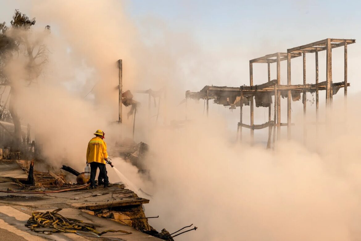
It’s a project that has been in the works for years. But in the wake of the Los Angeles’ January fire storms, their release coincides with renewed public anxiety over wildfire risk, the state’s fragile home insurance market and the management of development in places most prone to burning.
Why is the danger zone growing?
Different colors come with different rules.
In orange “high” hazard zones within the so-called local responsibility areas, newly constructed homes must meet heightened fire-resistant building standards. Anyone hoping to sell a home will also have to alert would-be buyers of the elevated danger with a disclosure form.
Homeowners who find themselves in the “‘very high” hazard zones will be subject to those rules and more. They will also need to clear a 100-foot circle around their property free of brush, dead trees and other flammable materials. New subdivisions will also need to be carefully designed with multiple evacuation routes, adequate water supply infrastructure and built-in fuel breaks in place.
In the state responsibility area, all the above requirements apply across all three levels of hazard.
In theory, the yellow, orange and red areas aren’t supposed to grow all that much from decade to decade.

Unlike an insurance company’s risk assessment of a house in the woods, which might take into account its composite wood sidings or the scraggly tree limbs overhanging its roof, hazard maps only take into account the lasting facts about a place. That includes topography, climate and vegetation patterns. A home perched at the top of a steep hillside, surrounded by dense forest or occupying a known wind tunnel is more likely to skew yellow, orange and red, no matter the composition of its sidings.
“The reason we map these areas is to tie these really important wildfire mitigations to them, helping us to ensure that as we build out new communities we’re building to the level of hazard that exists, giving them an increased chance of surviving a wildfire,” said State Fire Marshal Daniel Berlant.
In other words, these maps are not meant to take into account whether people have hardened their homes or cleared their yards of brush. They’re meant to highlight the places where people should be doing those things.
If the maps are based on mostly immutable characteristics, why have the hazard areas exploded across California since they were last drawn up in 2011? Three reasons, said Berlant.
The first is climate change. A warming planet makes fuel drier and fire weather more severe.
The second is technological. New modeling methods have allowed CalFire’s in-house data wizards to more precisely estimate where the hazard is highest. Included among the new tools are hyperlocal simulations of weather patterns and specific estimates of ember size based on an area’s vegetation (burning grass makes small, ephemeral embers, burning trees spit out bigger and longer burning ones).
The third, and perhaps important reason, is legal. Though prior versions had distinguished between “moderate,” “high” and “very high” hazard zones in areas under CalFire’s remit, the maps only showed the most dangerous bits of the local responsibility areas. State legislation in 2021 required the department to draw up new maps showing all three categories for both local and state jurisdictions.
Berlant likes to emphasize the distinction between CalFire’s “hazard” assessments and the “risk” calculations performed by insurance companies in an effort to head off what he said is the most common reaction to the new maps from members of the public.
“‘How is this going to impact my insurance?’ That really becomes the number one driver,” he said.
For years, insurance companies have been pulling back from California’s wildfire areas, leaving homeowners with few options but the FAIR Plan, a skimpy policy of last resort.
Berlant stresses that CalFire’s colorful maps aren’t going to tell insurance conglomerates anything they don’t already know.
“They’re already incorporating these hazard factors and then adding so much more to them to determine the availability and affordability of their products,” he said.
Effect on insurance and home prices
That may be a tough sell to wary homeowners.
The state of Oregon’s release of its own hazard maps in 2022 sparked a political backlash in many of the state’s rural counties. Many homeowners saw the elevated hazard designations as a kind of scarlet letter sure to depress property values and invite insurance companies to jack up rates. False rumors began to spread that anyone who failed to update their homes to match the fire-resistant building code would have their homes seized by the state.
Nothing has reached quite that fever pitch in California just yet. In Lake County, one of the areas of the state that has seen the most growth in its designated hazard territory, some local officials have publically lambasted the state.
“They give us a public hearing process that’s lip service only…the state has basically thrust this down our throats,” Lakeport Fire Chief Patrick Reitz said in February, according to Lake County News. Local governments are required to take public comment for 90 days, but must ultimately approve the maps without removing any hazard areas (though they are allowed to make additions).
On top of any concerns about insurance, the requirement that property sellers disclose the level of hazard to potential buyers may add to the cost of living in California fire country. A study from 2023 found that homes sold with this disclosure requirement in California sold for 4.3% on average that comparable nearby homes just outside the hazard zone.
“I do think that people in the state of California, especially now, are aware of fire risk,” said Matthew Wibbenmeyer, an economist with the environmental think tank Resources for the Future and one of the authors of the study. But having to sign a disclosure form spelling out exactly what that risk entails “really makes this a more salient factor to people’s decision making at the time of sale,” he said.
But many real estate agents in these fire prone areas don’t seem especially concerned about the maps — for now.
Dave Westall, president of the Tahoe Sierra Board of Realtors, lists his top concerns about the local real estate market: The lack of availability of insurance, high interest rates and general economic uncertainty. An increase in the number of homes that will need to provide hazard disclosures when they sell doesn’t even crack the top ten.
“All of our areas have been in these high fire severity areas for as long as I can remember,” he said. “We’ve been giving people fire disclosures for I don’t even know how long.”
It’s the same story down the foothills in Auburn, where Bill Evans is director of the Realtor board in Placer County. The new maps aren’t telling locals anything they don’t already know, he said.
“We’ve been dealing with high fire hazard severity zones for a long time,” said Evans. “Whether it shows up on the expansion of a map or not, it’s going to be a FAIR plan policy anyway for that homeowner.”

If anything, the maps are likely to understate the extent of the danger.
As the Los Angeles Times reported in February, only a fifth of the properties inside the Eaton Fire scar in Altadena were deemed “very high” hazard. Coffey Park, the Santa Rosa neighborhood torched by the Tubbs Fire in 2017, was miles from the demarcated red zone in CalFire’s prior maps.
That’s because the hazard maps are meant to predict the likelihood of wildfire, said Berlant, not “conflagrations.”
“This is when one home catches on fire and it spreads to the next and to the next and to the next — and then miles into Altadena and the Pacific Palisades were destroyed,” he said.
Predicting that kind of disaster would require a model that takes into account more than natural topography, weather and vegetation. It would need to consider the heat generated and the embers produced when different types of homes, cars and RVs go up in flames. The width and orientation of roads that can serve as man-made fire breaks is another possible input. It would also need to take into consideration just how closely buildings are packed together, a leading predictor of whether a home burns in these fires.
“It’s going to need to be a focus of ours into the future,” he said.

