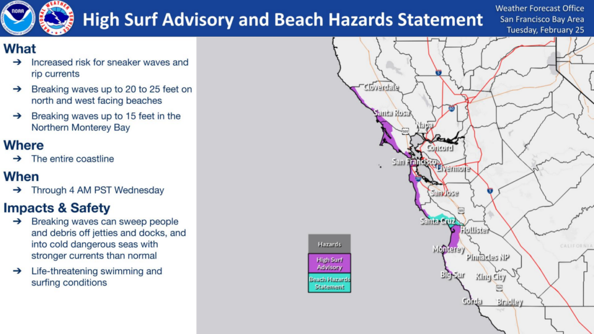
Big waves and hazardous beach conditions are expected along the coast early this week as the Bay Area sheds its overcast drizzle, temperatures rise inland and a chance of light rain returns for the weekend.
A moderate northwest swell is expected to enter the Bay Area’s coastal waters early Tuesday and bring waves of 15 feet to 18 feet, which will create hazardous coastal conditions for beachgoers, according to the National Weather Service.
The biggest waves are expected along the Sonoma and Marin county coastlines, with swells diminishing late Tuesday and into early Wednesday.
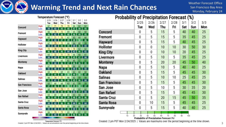
Meanwhile, higher than average temperatures are expected to peak in the mid- to upper-70s, particularly along the San Francisco Bay shoreline and the Central Coast’s inland areas, according to the Weather Service.
(Exedra note: It’s common in February to fall for this “false spring” — magnolias, daffodils, and flowering trees start to bloom and the warm temperatures push winter out of our minds. Phenology is the study of seasonal events, and according to researchers, false spring events that trick plants and animals out of dormancy early are becoming more common. You can track “first leaf and first bloom” indices of these early season events in plants across the country, based on recent temperature conditions, at the National Phenology Network’s “Status of Spring” site HERE.)
Those temperatures are expected to drop Thursday and Friday as increasing chances of light rain dominate the forecast heading into the weekend.
The biggest chance for some weekend drizzle is in the North Bay as a large low-pressure system pushes east out of the Pacific Northwest but largely remains to the north of the Bay Area.
The post Big waves along the coast, high temperatures inland give way to weekend Bay Area drizzle appeared first on Local News Matters.