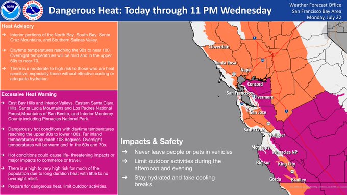
Tuesday is likely to be the hottest day and temperatures for some far inland areas could reach 108 degrees, according to the National Weather Service. Although the latest heat wave isn’t expected to set temperature records, dangerous heat will still pose risks for heat-related illnesses.
An excessive heat warning is in effect from 11 a.m. Monday to 11 p.m. Wednesday for the East Bay Hills and interior valleys, eastern Santa Clara Hills, Santa Lucia Mountains and Los Padres National Forest, mountains of San Benito, and interior Monterey County including Pinnacles National Park.
A heat advisory is in effect for interior portions of the North Bay, South Bay, Santa Cruz Mountains and Southern Salinas Valley.
The weather system will also bring a chance of dry thunderstorms late Tuesday into Wednesday, the weather service said.
Some minor coastal flooding is possible Monday night in bayside parts of the North Bay, as well as the San Francisco Embarcadero.
Residents in areas where extreme heat is forecast are advised to drink plenty of fluids, stay in air-conditioned rooms, stay out of the sun, and check up on relatives and neighbors. Children and pets should never be left unattended in vehicles.
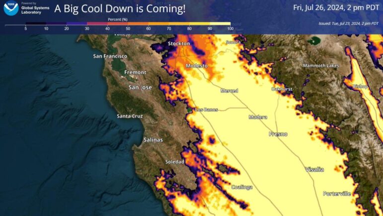
A big cooldown is expected starting Friday: