A local emergency was declared Monday in Sonoma County in response to the Point Fire which has burned nearly 1,200 acres northwest of Healdsburg.
Declaring a local emergency allows the county to request state and federal assistance for response and recovery efforts, according to County Executive M. Christina Rivera. The Board of Supervisors will hold a special meeting within the next week to consider ratifying the declaration.
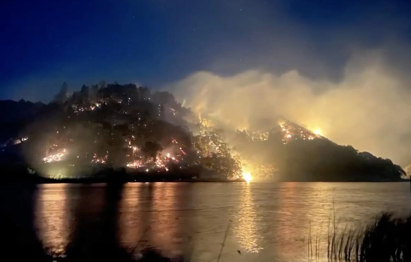
The Point Fire began Sunday afternoon at about 1 p.m. above Dry Creek Valley near Stewarts Point-Skaggs Springs Road. As of Monday evening, the fire remained contained at 20 percent.
Some residents have been evacuated and others remain under an evacuation warning.
Dry conditions and warm northerly winds have heightened wildfire risks throughout Northern California Monday and prompted the National Weather Service to issue a red flag warning for parts of the North Bay.
The warning remained in effect until at least 8 p.m. Monday as humidity levels drop down into the single digits for some areas and wind gusts of up to about 35 mph are expected in the North Bay mountains — conditions that are expected to increase the difficulty of fighting the Point Fire in Sonoma County.
“Winds will transition to more of an on-shore, more of a moister flow that should help increase humidity over the next few days,” said National Weather Service meteorologist Nicole Sarmet. “Today is kind of the last bad day.”

Temperatures for interior north and east bay regions should top out in the mid-80s Monday, gradually rising throughout the week to reach into the 90s on Friday and the low 100s Saturday, Sarmet said.
While the red flag warning is for the North Bay, particularly the higher elevations in Napa and Sonoma counties, there’s still a widespread fire danger throughout the region.
Monday’s meteorological conditions could also complicate efforts to douse the Point Fire, currently burning roughly 1,200 acres in the southeast region of Lake Sonoma.
Smoke from that fire led the Bay Area Air Quality Management District to issue an air quality advisory for Tuesday and a Spare the Air alert for Monday.
Smoke from the fire is expected to impact Sonoma, Napa and Solano counties most heavily and people can check their local impacts at the U.S. Environmental Protection Agency’s smoke and fire map here fire.airnow.gov.
While the fire is burning, people should expect smoky, hazy skies and to experience the smell of smoke and air quality may be in the Moderate to Unhealthy for Sensitive Groups range in portions of the North Bay, according to BAAQMD officials.
The fire danger isn’t limited to the Bay Area, as large swaths of the Central Valley and the Sierra Nevada foothills are also locked in a red flag warning until at least Tuesday morning.
Bay City News staff reporters Kiley Russel and Katy St. Clair contributed to this report.
The post Sonoma declares emergency for Point Fire; red flag warning issued across North Bay appeared first on Local News Matters.