Friday’s weather around the coastal East Bay was colder and wetter than average, according to National Weather Service data, and that trend is expected to continue into the weekend.
“We can see some thunderstorms potentially linger into Saturday evening,” said Weather Service meteorologist Roger Gass.
Friday’s daytime high temperatures were around 54 degrees, 10 degrees cooler than average.
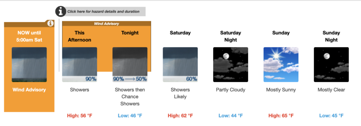
Saturday’s high temperature is expected to be around 59 degrees, dropping to the mid 40 inland and the 50s along the coast overnight. Thunderstorms are possible in the morning and and early afternoon, with rain likely between 11 a.m. and 2 p.m., according to the weather service.
Easterly winds of 10 to 14 mph could gust as high as 22 mph.
A wind advisory remains in effect until 5 a.m. Saturday for the East Bay Hills, according to the weather service.
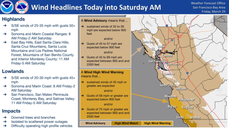
During that time, people can expect wind gusts of up to 45 mph in most affected areas, with stronger winds at some localized peaks.
After the weekend, things should settle down quickly and the sun should come out again, Gass said.
“Monday through mid-week we are expecting a warming and drying trend,” he said.
After that, more unsettled weather could be on the way for later in the week.