California is using more detailed data than ever before to try to guide decision-making about the impact of the state’s transportation systems on vulnerable communities.
An online data tool from Caltrans launched Monday focusing on the impacts of transportation infrastructure in neighborhoods, as well as transportation needs and equity of investment for future projects.
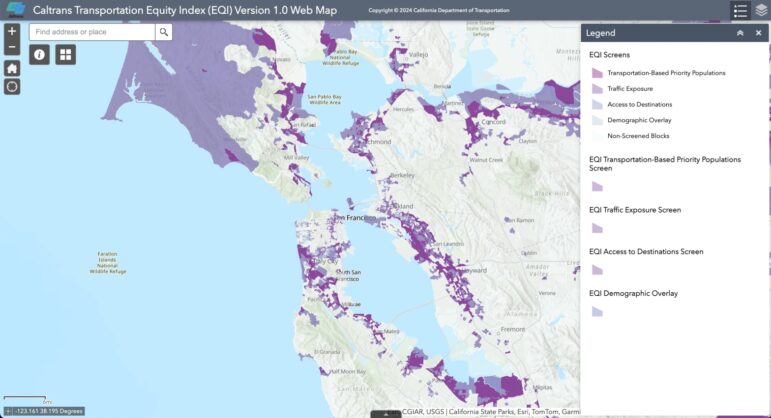
The Caltrans Transportation Equity Index, or EQI tool, allows users to access three interactive data dashboard layers that highlight areas that are most impacted by transportation issues such as traffic and traffic safety, environmental and health issues, and the availability of different transit options.
For example, the tool can help users understand, at a glance, that despite San Francisco’s widespread transportation access, traffic impacts in the city align with lower-income neighborhoods in the Tenderloin and Chinatown areas.
Transportation access is more available to residents in central and north Oakland than in the south part of the city, but those who live near Interstate Highway 580 and 880 are impacted the most by traffic effects.
California Transportation Secretary Toks Omishakin said at a virtual press conference announcing the tool Monday that the state’s transportation network is essential, it should not cause harm to its users and nearby communities.
“Transportation induced harms are inequitably distributed,” Omishakin said. “Historically, entire generations have been challenged from such harms. Transportation inequities can’t be addressed adequately without critical data to help identify priority populations most impacted by California’s transportation system,” he said.

The effort to create a specific data tool focusing on equity was begun in 2021. The data will complement the state’s CalEnviroScreen data dashboard showing other environmental factors. It uses external and internally developed data sets and will help inform policy makers on what future projects to prioritize.
The tool shows data by census tract, down to the block level. The three data dashboards act as layers a user can combine to show different information.
The first layer shows populations deemed “transportation burdened” based on household income and other socioeconomic factors, as well as federally recognized tribal land. The second layer shows traffic impacts and collision frequency.
The third displays data on which areas have the most access to destinations such as job centers and downtowns by different transit, bicycle, and pedestrian options.
“If that access is poor, then that may be a disadvantaged population,” said Eric Sundquist, Caltrans’ Acting Deputy Director for Equity, Sustainability, and Tribal Affairs.
Additional functions will be available in the future as the tool continues to be developed.
“The EQI tool is one of the many ways Caltrans is working to ensure equity is ingrained in our transportation practices,” said Caltrans Director Tony Tavares.
Find more HERE about the upcoming informational session on how to use the data dashboard, hosted by Caltrans on March 20, from 2-3 p.m.
Also, Caltrans is seeking public input on regional transportation in an online survey for Bay Area users: