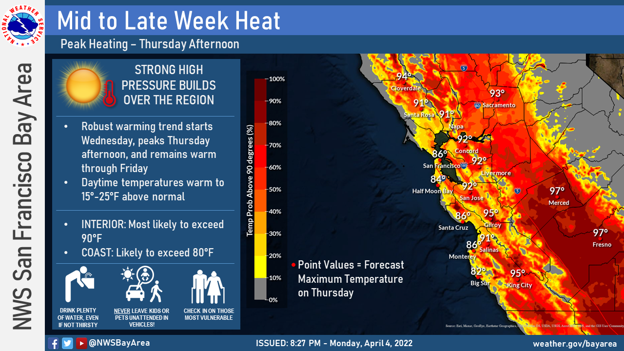
Spring may look more like early summer by the end of the week as a mini heat wave comes to the Bay Area, the National Weather Service reported.
Significant warming is expected on Wednesday and Thursday, and highs could rise 20 degrees by Thursday, according to the National Weather Service. Daytime temperatures Wednesday will rise by 5-10 degrees above normal at the coast and by 10-20 degrees above normal throughout interior locations. On Thursday, highs are expected to be 15 to 25 degrees above normal, with coastal areas reaching the 80s and inland areas topping 90 degrees.
Who likes roller coasters?🙋♂️🎢 Take a look at these forecast temperature traces. Mini heat wave🥵 later this week, but much colder weather returns early next week. Visit https://t.co/W1YfxSzLcY for your local forecast #cawx pic.twitter.com/0mGMuGY8gt
— NWS Bay Area 🌉 (@NWSBayArea) April 5, 2022
Overnight temperatures are anticipated to cool adequately enough to limit greater, more widespread heat risks.
A similar April heat event of this magnitude last occurred April 5-10, 1989. The NWS reminds people to stay hydrated and check in with those people most vulnerable to elevated temperatures.
However, the above average heat won’t stick around. By early next week, cooler than normal temperatures may bring a possible return of some overnight rain, according to the weather service. Highs on Sunday in Piedmont are forecast at around 66 degrees, with high temperatures falling to only 60 degrees Monday.