Since last week, PG&E has sent helicopters to the East Bay as a part of its Community Wildfire Safety Program. The work is expected to be completed this week.
“Given the continued and growing wildfire threat, we have expanded and enhanced our vegetation and safety work,” said PG&E spokesperson Tamar Sarkissian. “This includes addressing vegetation that poses a higher potential for wildfire risk to maximize the safety of our customers and communities.”
Sarkissian stated that these inspections will span across approximately 25,200 miles of distribution lines in high fire-threat areas throughout Northern and Central California.
The inspections, which began in April and will continue through August, take place six days as week between 9:00am and 4:00pm (weather-depending).
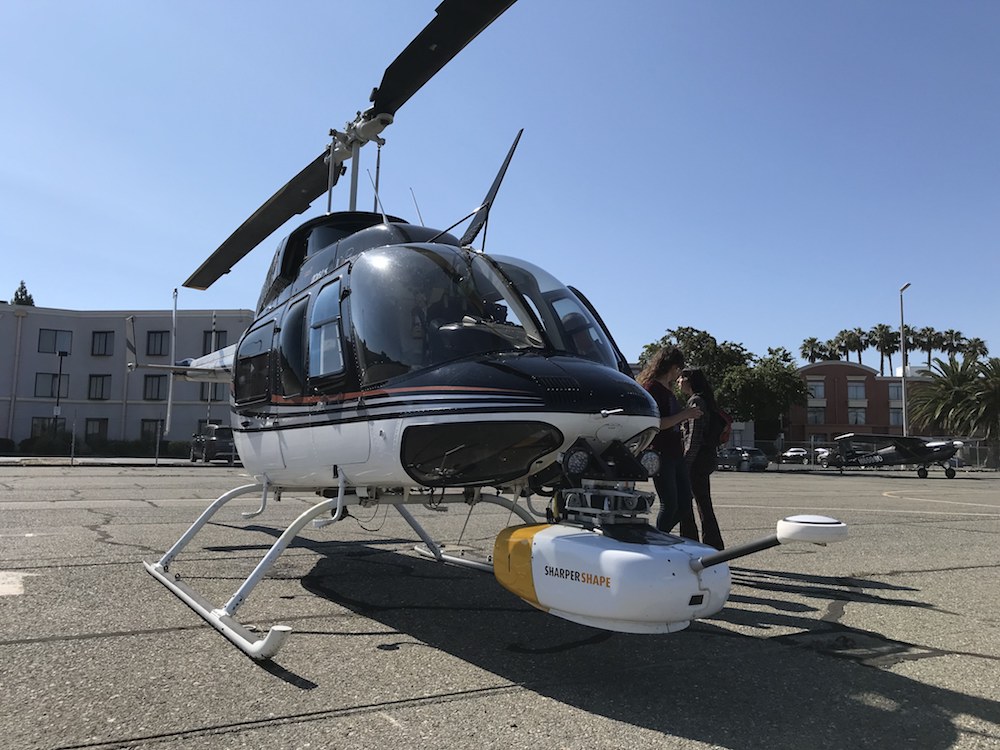
To do this, PG&E uses helicopters equipped with Light Detection and Ranging (LiDAR) technology to help gather data that will reveal patterns and identify hazardous trees that could fall into power lines.
The LiDAR data, which PG&E has employed since 2010, will supplement PG&E’s ground inspections and continue to support transmission line project work. Last year, PG&E captured LiDAR data for a majority of electric lines running through extreme fire-threat areas.
“These LiDAR inspections will help us monitor the effectiveness of our tree pruning and removal activities and identify any changes to the environment, including new tree plantings that may impact power lines,” said Sarkissian.
According to Sarkissian, PG&E plans to capture and analyze LiDAR data for Tier 2 & 3 high fire-threat areas. After the East Bay inspections, PG&E will move on to other Bay Area counties, including Santa Clara, San Mateo, Napa, Solano and Marin counties.
Residents can identify the PG&E helicopters by looking for a “Fire Survey” decal that may be displayed on the bottom of the aircraft.
“Helicopters will generally fly at an altitude of 300 to 500 feet, along distribution power lines,” said Sarkissian. “We will have four helicopters flying at any given time throughout our service area. The Piedmont work is likely being completed by one helicopter.”
In addition to above-ground inspections, PG&E plans on meeting and exceeding state vegetation and fire safety standards, pruning overhanging branches and limbs directly above and around power lines; and pruning or removal of certain tree species that pose an increased potential risk of falling into power lines during extreme weather conditions.
“The safety of our customers and the communities we serve is our most important responsibility.”
Tamar Sarkissian, PG&E spokesperson
Sarkissian said that residents should expect automated phone calls from PG&E in advance of scheduled helicopter flights in their community.
PG&E reminds residents if they see a low or downed power line, they should always assume it’s live, stay away and keep others away, and call 911 and PG&E (1-800-743-5000) immediately.
For more information, customers can visit pge.com/enhancedveg or email at wildfiresafety@pge.com. They can also call 1-877-295-4949.