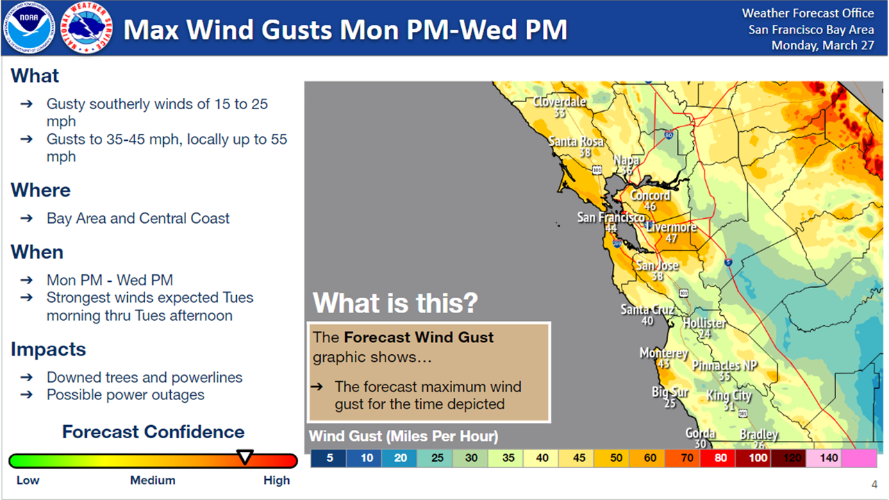
Gusty winds could blow around unsecured objects, (more) tree limbs could fall, and power outages are possible when strong winds whip the Bay Area starting Tuesday morning.
A wind advisory will be in effect from 5 a.m. to 2 p.m. Tuesday, the National Weather Service warned Monday afternoon. That level of meteorological alert signals the weather service’s expectation of sustained winds of 31 to 39 mph for an hour or more and/or wind gusts of 46 to 57 mph for any duration. As of Monday afternoon, Bay Area forecasts showed peak wind gusts reaching 55 miles per hour with stronger gusts possible at higher elevations.
The wet, windy weather will likely arrive late Monday and slowly taper off by Thursday, but not before dumping up to 3 or 4 inches of rain in the hardest hit areas.
The East Bay, South Bay valleys, and the San Francisco Peninsula can expect from between a half-inch to 1 1/2 inches of rain as the weather moves south across the region in bands, with a possible break expected before Wednesday’s showers.
In addition to the cold, wet and windy conditions, coastal areas will see an increase flood danger as a storm surge of one to two feet results in “astronomical high tide levels” that should peak at 12:54 p.m. Wednesday and 1:18 a.m. Thursday, according to the weather service.
Forecasters recommend using extra caution when driving — especially if operating a high profile vehicle — and securing outdoor objects.