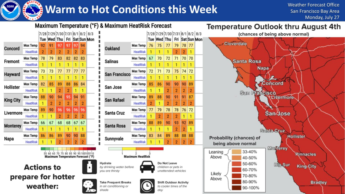
Warm weather will gradually build across the Bay Area this week, with inland communities facing increasing heat and elevated fire weather concerns, and dangerous beach conditions even as cooler temperatures persist near the coast.
In an early Tuesday morning advisory, the National Weather Service said breezy onshore winds will continue each afternoon and evening through the middle of the week, helping keep coastal areas relatively mild while inland temps climb. Moderate heat risk is expected to develop across many interior locations beginning Thursday and continue into the weekend. Forecasters said the hottest days are expected on Saturday and Sunday, when interior parts of the North Bay, East Bay and South Bay could see highs in the upper 80s to near 100 degrees.
Temperatures in Piedmont are expected to climb into the high 70s by Friday, according to the National Weather Service.
Fire danger will also remain elevated through midweek across the Diablo Range, Santa Lucia Range and other inland areas because of hot temps, low daytime humidity, breezy afternoon winds and only limited overnight moisture recovery.
The weather service urged residents to avoid activities that could spark a wildfire, including leaving campfires unattended or dragging chains behind vehicles.
Along California’s Pacific coast, hazardous beach conditions are expected to continue through at least Saturday, with an increased risk of sneaker waves and strong rip currents. Forecasters urged beachgoers to stay off jetties, piers and rocks, remain out of the water if surf becomes dangerous, and never turn their backs on the ocean.