Warm temperatures and sunny skies will give way this week to increasingly cooler days and the likelihood of rain and possible thunderstorms in the Bay Area, according to the National Weather Service.
Above-normal temperatures and dry weather will continue through Wednesday before unsettled conditions return Thursday, bringing below-normal temperatures and beneficial rainfall across the region, forecasters said.
“We are expecting a change in the pattern. It’s going to be pretty substantial,” said Weather Service meteorologist Rachel Kennedy.
On Thursday and Friday, more areas around the region will start dropping into the 60s and low 70s, Kennedy said.
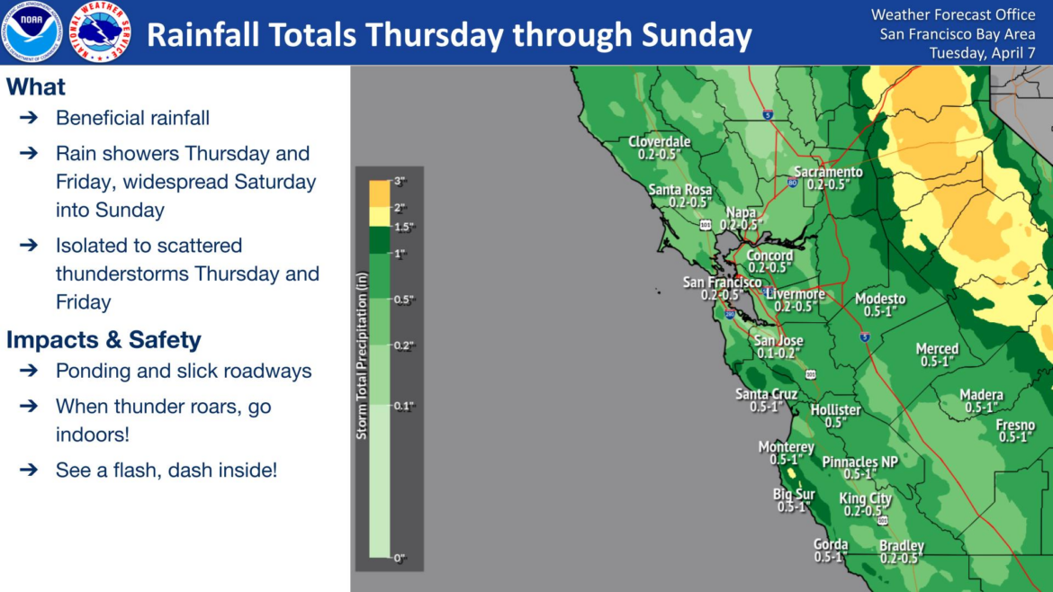
Rain is expected to begin Thursday and continue into the weekend, with showery conditions Thursday and Friday becoming more widespread Saturday and Sunday. The system is expected to bring light to moderate rainfall that could create ponding on roadways and slick travel conditions in parts of the Bay Area and Central Coast.
Rain totals will likely be around a quarter of an inch along most of the Bay shoreline and in lower elevation areas. Some areas could see as much as three quarters of an inch of precipitation, and higher elevations like the North Bay mountains and East Bay hills will see totals of between three quarters of an inch and one inch of rain.
The potential for thunderstorms peaks on Friday afternoon — especially in the interior areas of the East Bay, South Bay, and Central Coast.
After the wet weekend, long-range indications are showing the possibility of more low-pressure systems moving through the region, which could bring more rain during the next couple of weeks.