A bit of Bay Area Cold War history and great Bay Area views await visitors to Mount Umunhum in the Santa Cruz Mountains above San Jose.
At 3,486 feet, Mount Umunhum is among the highest peaks in the Bay Area. On a clear day, it’s possible to see skylines of the region’s three largest cities and as far north as Mount Tamalpais in Marin County. From a few spots on the twisty road up the mountain, Monterey Bay is also visible. Downtown San Jose, 22 miles away, is easy to spot, as are Mount Hamilton and Mount Diablo.

Located in the more than 19,000-acre Sierra Azul Open Space Preserve, Mount Umunhum is reached by driving two-lane roads from Camden Avenue into the mountains south of San Jose. It takes about 35 minutes to drive there from state Highway 85. On a recent Sunday, the summit parking lot had plenty of room for vehicles.
Umunhum means “resting place of the hummingbird” in the language of the native Amah Mutsun people who lived in the area.
“The spoken word sounds like the noise a hummingbird makes while hovering” reads a sign at the summit. While no hummingbirds were seen during our visit, the relatively rare Western Purple Martin, a bird in the swallow family, has been sighted in the area, according to Ryan McCauley, a spokesman for the Midpeninsula Regional Open Space District.
Andrew Lu, a San Jose resident, was drawn to the area, which sees occasional snow on winter days and fierce heat in the summer, for the views and hiking. “It’s actually our second time here,” he said.
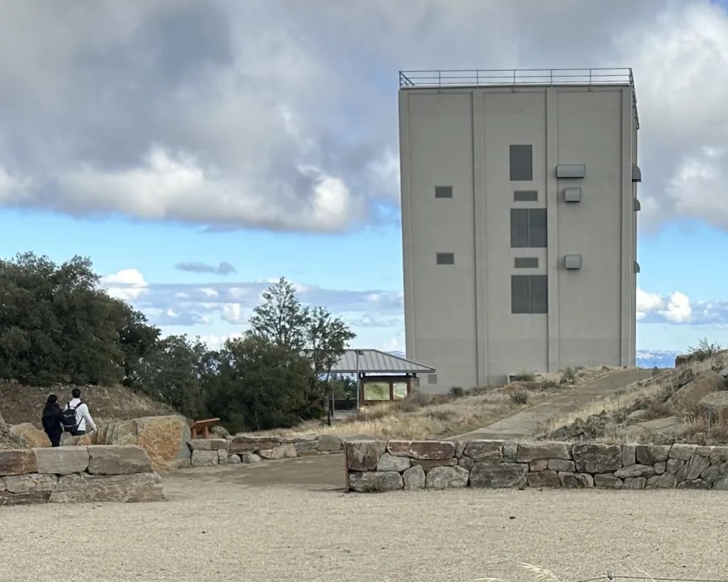
For others, Mount Umunhum is known as the peak south of San Jose with a box on top of it. The cube, as it’s often called, is a radar tower left over from the Cold War, when dozens of radar stations operated along the West Coast.

From 1957 to 1980, the summit housed the Almaden Air Force Station, a home to military members and their families. The Midpeninsula Regional Open Space District, which manages open space in the South Bay, purchased the 44-acre station in 1986. In 2009, the district received a $3.2 million in federal funding to clean up the decommissioned base. Some 3,000 cubic yards of hazardous materials were removed, and 80 structures were recycled before the site opened to the public in 2017.
Visitors can walk and hike on a cement path with stairs to the multi-story cube at the restored summit. While the building is closed to the public, the area, which is open from 7 a.m. until half-hour after sunset, offers a ceremonial circle, great views and information and exhibits about Umunhum’s history. Hikers will also find trails at the summit, including a 3.5-mile trail from Bald Mountain that winds through the chaparral foliage. The summit is arid and rocky, but green trees spill down the mountains below.
The short trail to Mount Umunhum’s summit includes benches, restrooms and picnic tables. There’s a disabled parking and drop off areas for those who can’t walk to the viewing area.
The Midpeninsula Open Space District offers free “Sentinel in the Sky” leisurely quarter-mile hikes leaving from the parking area at the top of Mount Umunhum Road in San Jose at 1 p.m. Jan. 12 and Feb. 9. Retired Midpen ranger Ken Miller and Umunhum Conservancy President Basim Jaber will share details about living on Mount Umunhum during the Cold War. Visit openspace.org/events/ for more information.
The post South Bay’s Mount Umunhum offers great regional views, interesting Cold War history appeared first on Local News Matters.
